


Mapping of England’s Peatlands Finds 80% Have Become Degraded
Scientists have now comprehensively mapped peatlands in England, and their work has revealed that 80% of the country’s peatlands and peat soils have become dry or degraded. Using a combination of satellite imagery and AI technology along with data analysis of existing and new field data, scientists developed a map of peaty soils known as […] The post Mapping of England’s Peatlands Finds 80% Have Become Degraded appeared first on EcoWatch.
Scientists have now comprehensively mapped peatlands in England, and their work has revealed that 80% of the country’s peatlands and peat soils have become dry or degraded.
Using a combination of satellite imagery and AI technology along with data analysis of existing and new field data, scientists developed a map of peaty soils known as the England Peat Map.
“Trying to map something that’s largely underground, changes in volume depending whether it’s rained recently, and tries to swallow you up every time you set foot in it comes with its challenges, which makes this map extraordinary in its accomplishment and something of a global first,” Sallie Bailey, chief scientist at Natural England, which published the map, said in a statement.
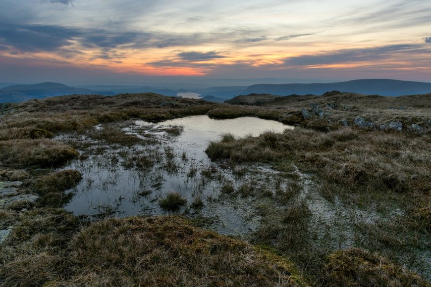
According to the UK Department for Environment, Food and Rural Affairs (Defra), England’s total surface comprises about 8.5% peaty soil, with some of the biggest expanses of peatlands covering the Pennines in northern England, North York Moors and parts of the Lake District in northwestern England uplands in the South West region of England.
Peaty soil and peatlands are important carbon sinks. UN Environment Programme reported that peatlands, which cover only 3% of total land on Earth, can store twice the amount of carbon as all the world’s forests together can sequester.
But when peatlands are degraded, often for urban development, agricultural use and commercial forestry, they can become sources of carbon emissions rather than sinks. According to Natural England, emissions from degraded peaty soil currently make up about 2% of all emissions in England. Degraded peat soils make up 3.5% of all emissions in the UK.
In addition to serving as a critical carbon sink, peatlands and peat soils are an important natural habitat for vulnerable species, and they naturally clean nearby water bodies. As such, scientists and officials hope the new map will emphasize the dire status of England’s peatlands and better inform policies and conservation and restoration efforts.
Based on the map and data from the UK Office for National Statistics, peatlands provide economic value in the hundreds of millions of pounds for their role in proving clean drinking water and 274 million pounds ($364 million) for their recreational value. Further, restoring 55% of degraded peatlands in England would create an estimated value of £50 billion pounds ($66.5 billion).
“The benefits of healthy peatlands are well documented — they are our biggest natural carbon stores, essential to the water cycle, and refuge to some of our rarest plants and wildlife, such as the carnivorous sundew plant, marsh violet, and charismatic birds like golden plover and curlew,” Tony Jupiter, chair of Natural England, said in a statement. “The England Peat Map will allow us to make far better and more informed decisions when it comes to managing peatlands — targeting restoration efforts to the most degraded peat and identifying the best opportunities for nature recovery.”
The post Mapping of England’s Peatlands Finds 80% Have Become Degraded appeared first on EcoWatch.


